
Downey ZIP Code Areas and Mailing Routes
Downey's verified residential mailing ZIPs are 90240, 90241, and 90242. Each is a USPS delivery geography. None is a legal neighborhood, a parcel boundary, or a public owner filter. The table gives an orientation drawn from official addresses and post-office anchors, while a specific address still needs a live postal check.
| ZIP | Areas or orientation | Post office or anchor | What to remember |
|---|---|---|---|
| 90240 | North and northwest Downey | Dennis the Menace Park, 9125 Arrington | Mailing route, not a legal neighborhood boundary |
| 90241 | Central, downtown, and civic area | Downey Main Office, 8111 Firestone Boulevard; City Hall and Library on Brookshire | Civic addresses cluster here, but the ZIP does not define the city center |
| 90242 | South and southeast Downey | South Downey Station, 7911 Imperial Highway; Apollo Park, 12544 Rives | Southern Imperial and Rives orientation |
A ZIP code directory is most useful when it hands a broad route to a narrower key. Use the street, AIN, parcel map, or official name search next, rather than treating a ZIP match as a resident match.
90240: North and Northwest Downey
Postal ZIP 90240 is the north and northwest orientation in Downey's mailing geography. Dennis the Menace Park at 9125 Arrington is a useful official address anchor in that area. The anchor helps a researcher understand the route, but it does not draw a city or neighborhood line. Nearby parcels, streets, and civic labels must be checked on their own terms.
For a resident-directory question, 90240 can narrow the first pass, not finish it. USPS can verify whether a specific street address is delivered through 90240. The Assessor can then translate the situs into an AIN. A parcel result may connect to a deed or permit, while a current household clue may require a different source. The word “resident” should never be inferred from the postal label alone.
Old records can carry a different city or ZIP notation. Preserve the original line, then compare it with the current USPS result and legal parcel description.
90241: Civic and Downtown Downey
Postal ZIP 90241 is the central and civic orientation. The Downey Main Office is at 8111 Firestone Boulevard, and City Hall and the Downey City Library are on Brookshire Avenue. Those official addresses make the route easy to place, but the presence of a civic anchor does not turn 90241 into a municipal boundary or a single neighborhood.
A searcher who begins with a 90241 mailing line can use the ZIP as a filter for notes, then validate the full street address. A business, library, or public building may be in the same ZIP as a private parcel while carrying a wholly different record trail. Use the record type that fits the question: permit, deed, court file, directory volume, or city request.
City survey data reported 43.2 percent of 986 respondents in 90241 and also charted 90240 and 90242. That is a survey profile, not ZIP population and not a count of residents.
90242: South and Southeast Downey
Postal ZIP 90242 covers the south and southeast orientation around Imperial Highway and Rives. South Downey Station at 7911 Imperial Highway and Apollo Park at 12544 Rives are official address anchors. The route includes a southern orientation, but no verified source supplies a single ZIP split year, unique ZIP, or exact city-line mismatch polygon.
Use the same careful order here as elsewhere: confirm the delivery line with USPS, resolve the parcel with an address or AIN, and then choose the official record custodian. A postal directory can point the search toward 90242, but it cannot expose a public ZIP-wide owner or household list through the Assessor tools.
Finding Residents by ZIP Code
Finding residents by postal route works best as a narrowing workflow. The postal route can help organize a set of known addresses, or help compare an old mailing line with a current one. It cannot replace the address-to-AIN step or the access rules for voter, deed, court, and vital records. A careful ZIP code directory labels the postal clue as a clue.
- Write down the complete name or street address and keep the source date.
- Run the address through USPS to confirm the ZIP, city field, and any apartment or suite detail.
- Use the Assessor Portal or map to find the AIN and legal parcel context.
- Choose the custodian that answers the real question: deed ownership, court party, city file, historical occupant, or authenticated voter status.
- Once a ZIP narrows to a street, use the Downey street directory for the address-keyed chain.
Do not call a blank result proof that no one lives in a ZIP. Postal data, parcel data, and person-linked records are built for different purposes.
Validate a Downey ZIP Code Address
The USPS city-and-state form is the direct check for a delivery route. Its required field is Street Address. Apt, Suite, or Other is optional. City and State are required, while ZIP is optional. The Find button returns the postal result. A full apartment line matters because a route confirmation may change when the unit or street suffix is wrong.
USPS validates delivery routing, not city residency. It does not tell a researcher who owns the parcel, who receives mail, or who lives there. Use the result to clean an address before the Assessor, recorder, court, or library step. This division is the core of a trustworthy ZIP code directory.
| USPS field | Required | Use |
|---|---|---|
| Street Address | Yes | Primary delivery address. |
| Apt / Suite / Other | Optional | Adds unit or secondary location detail. |
| City | Yes | City entry used for the postal query. |
| State | Yes | State dropdown selection. |
| ZIP | Optional | Existing route clue that can be checked. |
The USPS city and state lookup supplies the live form used to verify an address.
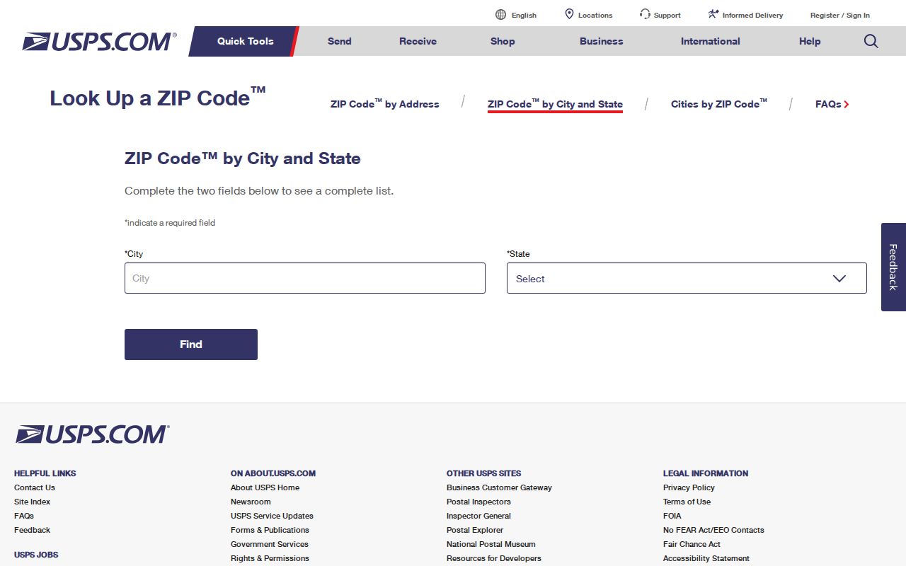
The USPS form confirms a mailing route, which is the first layer of a Downey postal directory search.
ZIP, Situs, Mailing, and Legal Description
Four address terms often sit beside each other in a Downey record trail. The ZIP code routes mail. The situs is the physical parcel. The mailing address is the destination for tax or owner correspondence. The legal description identifies the lot, tract, or parcel in a deed. The same property can carry an old mailing line, a new ZIP, and a legal description that never uses the street name.
- ZIP
- A USPS delivery geography used to route mail.
- ZIP+4
- A more precise postal extension that does not create a city or ownership boundary.
- PO-box or unique ZIP
- A route built around a postal facility or special delivery use, not a general residential map.
- Carrier route
- A delivery path inside a postal geography; it is not a public household roster.
The Assessor accepts an address or AIN, not a public ZIP-wide owner filter. A deed uses its legal description and parties. A directory uses its own edition date. A postal directory should preserve all four layers instead of flattening them into “where a resident lives.”
ZIP Code Boundaries vs Downey Limits
ZIP boundaries and city limits answer different questions. USPS routes a letter. A municipal boundary determines which city government serves a place. A parcel or GIS boundary shows land. These lines can disagree, so a Downey mailing ZIP should not be used to claim that an address lies inside the incorporated city or in a named neighborhood.
Official planning areas such as Downtown Downey, the Civic Center, Downey Landing, Stonewood, Florence/I-5, Lakewood/Firestone, Rancho Los Amigos, and Rancho Business Park do not map one-to-one to the three ZIPs. The 2025 community-mapping exercise asked residents to define communities, which is a useful reminder that neighborhood names are not a settled official directory.
Voter records add another limit. The California voter status tool is an authenticated self-check, and voter-file disclosure is restricted by Elections Code and Government Code rules. It is not a ZIP-wide public resident browse.
The California voter registration guidance explains registration and confidentiality routes.
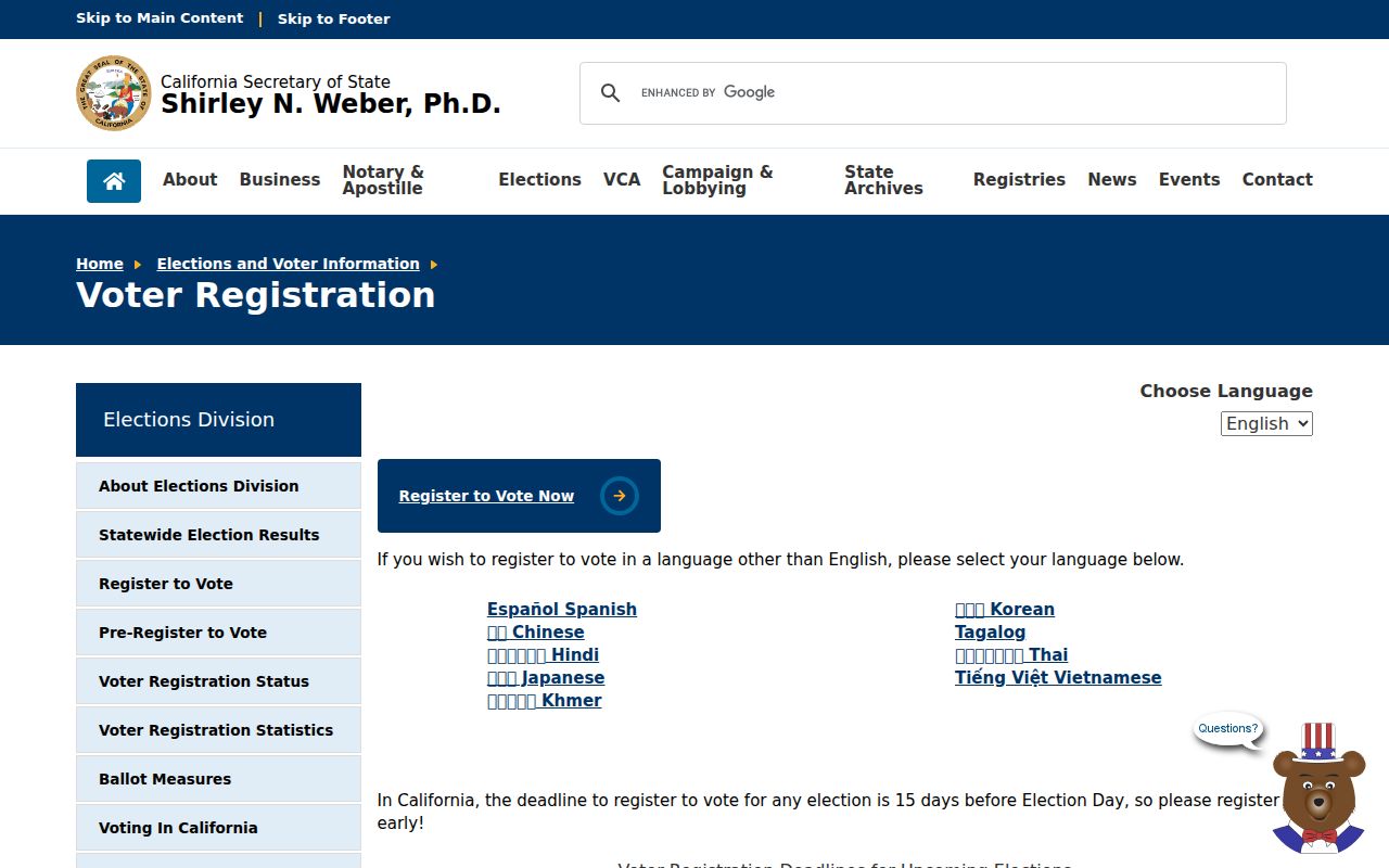
Registration guidance shows why a ZIP route and a voter record must not be treated as the same geography or access channel.
Downey ZIP Code Searches Meet Privacy
Government Code § 7924.000 and Elections Code §§ 2188 and 2194 limit voter-file disclosure. A released product may contain address, status, registration date, districts, party preference, and participation history for an approved purpose, but not ballot choices. Safe at Home and other protected categories are withheld. A ZIP filter, even when a requester is eligible for a voter product, does not make the file a general directory.
The California voter-record confidentiality statute is the source for the public-access boundary.
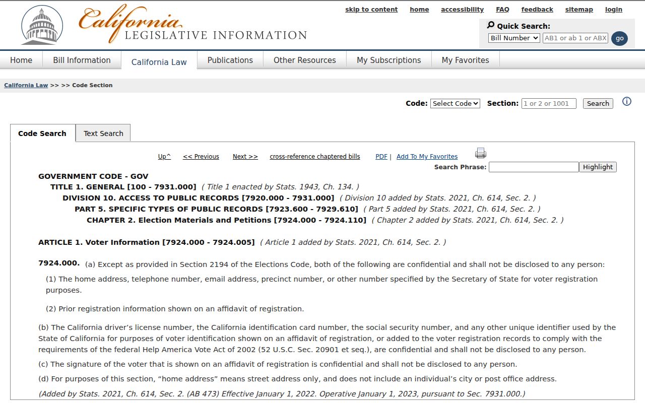
The statutory screen is a reminder that a lawful ZIP research purpose does not erase voter confidentiality rules.
Planning Areas Do Not Equal ZIPs
Downey's planning labels add useful local orientation but should not be used as ZIP substitutes. A civic address can sit in a route that also serves homes and businesses. A planning area can stretch across more than one mailing route. The safe practice is to cite the label as a planning clue, then verify the exact address with USPS and the parcel map.
The same caution applies to old records. A directory page, census schedule, or deed may use a historical city label, a cross-street, a rural description, or a neighboring postal town. Preserve the original language, then add the current ZIP as a separate field. That makes a historical postal directory useful without rewriting the past.
Recent voter-status results can also be time-bound. The LA County registration-status tool is a self-check, not a public ZIP list.
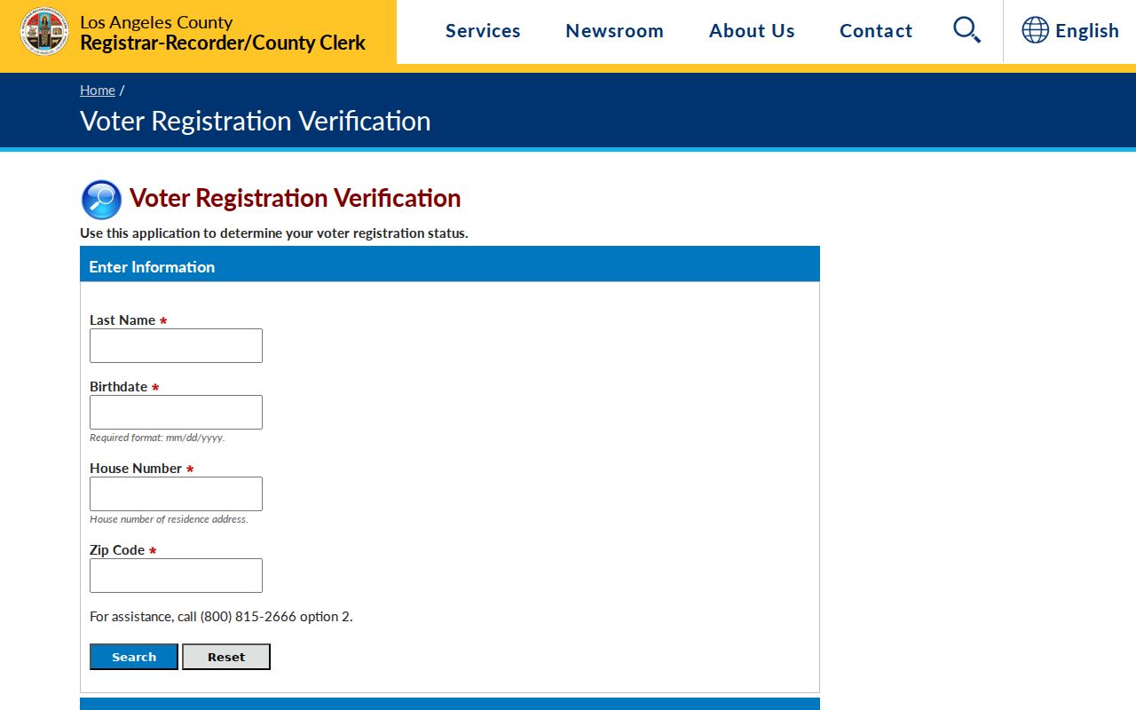
The official status route belongs to the authenticated voter, while the postal route belongs to the address.