
Street-by-Street Downey Resident Trail
A useful Downey street directory search follows the same address from one custodian to the next. Begin with the exact situs address, including unit details when known. The county Assessor Portal may resolve the parcel even when a name search would be uncertain. The resulting AIN, legal description, and map reference can then anchor a deed request, a permit question, or a comparison with an older directory.
Ownership and occupancy are different signals. The Assessor's public web pages suppress owner-name searching, and a deed records a transaction rather than a full household. Voter information has a restricted-purpose path, and a printed directory records listed subscribers. Walk the chain slowly so each result keeps its source and date.
- Run the street address in the Los Angeles County Assessor Portal. Save the AIN, situs, parcel status, use, legal description, and any sale clue.
- Open the Assessor Map and click adjacent lots. Record nearby AINs, tract or parcel references, dimensions, easements, and streets.
- Use the Assessor counter or lawful data channel to obtain owner and mailing information. A mailing address may differ from the situs.
- Take the owner name and likely acquisition year to the RR/CC index in Norwalk. Search the owner as grantee, then follow earlier grantors.
- Check Downey permit or code records for activity at the address, then compare the result with Haines cross-cross and other directory editions.
Downey Assessor Fields for an Address
The Assessor is the key address-to-parcel gateway for Downey. Basic Search and Map Search accept a street address or ten-digit AIN. Legal Search is aimed at legal-description work. A parcel-detail result can contain the situs or property location, roll detail and effective date, real-property value, recent sale information, boundary or legal-description data, building description, and recent parcel-change activity when applicable. The roll updates weekly except around roll release and tax extension.
That record is strong for the parcel and weak for a household. Owner information is available at Assessor district offices or through Property Data Sales, but the public website does not provide owner-name search. Downey parcels are served by the South District Office at 1401 East Willow Street in Signal Hill, with published phones 562-256-1701 and 888-807-2111 and weekday hours from 8 to 5.
| Field or control | Type | What it means |
|---|---|---|
| Basic Search | Tab | General property lookup. |
| Legal Search | Tab | Legal-description-oriented parcel research. |
| Map Search | Map control | Parcel selection and neighboring geometry. |
| AIN or Address | Text or autocomplete | One key is used; an AIN has ten digits and an address can include city or ZIP. |
| Owner name | Unavailable online | Counter or authorized data-sale channel only. |
The search-field table is the practical core of an address search: it tells a researcher which key can be entered and which key must be obtained elsewhere.
For a source view of the parcel map's fields, use the LA County Assessor Map help.
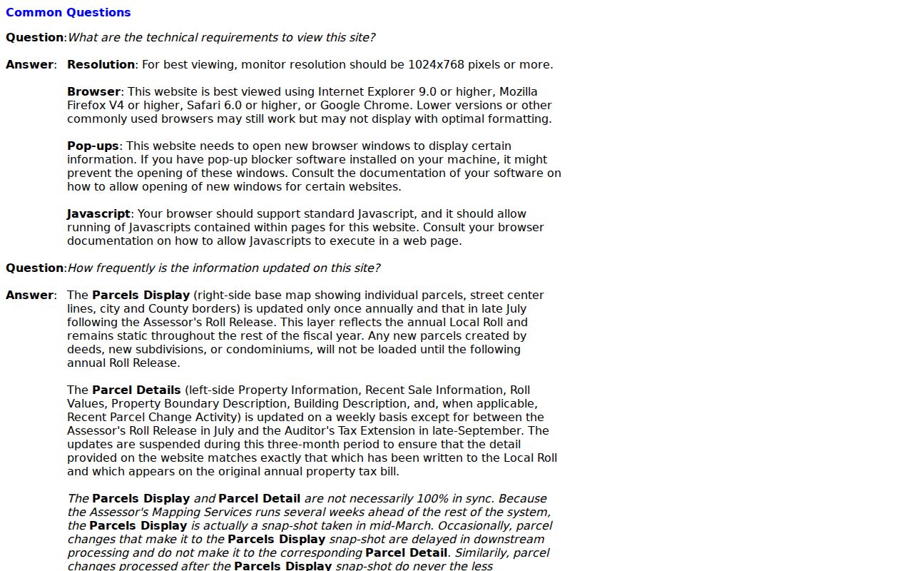
The map display ties a Downey street directory search to parcel geometry without turning a parcel card into a resident roster.
Mapping Adjacent Downey Parcels
After one parcel is resolved, the Assessor Map lets a researcher pan, click adjacent polygons, and open the surrounding parcel detail. Neighboring AINs, lot dimensions, tract references, easements, and streets form a useful block record. This is the cleanest way to move from one address to the next without guessing at a house number or street spelling.
The LA County Planning GIS-NET public tool offers identify, query, buffer, measure, export, print, aerial imagery, and Street View functions. Research records that GIS-NET is focused mainly on unincorporated county territory. Incorporated Downey work should favor the Assessor Map and city planning or public-works maps for jurisdiction-specific layers. Do not promise a buffer or owner layer that the local viewer does not expose.
Parcel adjacency is also useful for older research. A tract or parent-parcel reference can bridge a changed address, a split parcel, or a deed that uses a legal description instead of a street number. A map line describes land, not who sleeps in a building.
The GIS-NET public information page lists its query and measurement tools.
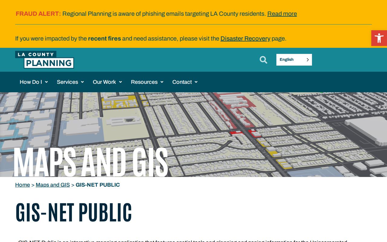
GIS-NET can add geographic context, but its unincorporated focus makes the Assessor Map the safer primary source for incorporated Downey parcels.
The LA County Assessor parcel map provides the direct map view used to compare adjacent lots.
Parcel geometry gives a street search a stable land key even when an old record uses a different address form.
Downey Records Searchable by Street
Address-keyed record sets overlap without being interchangeable. The coverage below shows what each record can contribute to a Downey street directory and where the gaps begin. The county recorder is the notable exception: it has a rich deed trail, but the index must be searched by party name and year at the office.
| Record set | Keeper | Street-level clue | Access |
|---|---|---|---|
| Assessor parcel | LA County Assessor | AIN, situs, use, value, building and legal facts | Free address/AIN portal; owner name withheld online |
| Assessor Map | LA County Assessor | Adjacent lots, tracts, dimensions and easements | Free map viewer |
| Recorder documents | LA County RR/CC | Deed parties, liens, sale history and legal descriptions | Norwalk name/year index; copies charged |
| City permits and code files | Downey departments | Applicants, contractors, project dates and inspection activity | Accela or focused clerk request; older coverage varies |
| Haines cross-cross | LA County Library Californiana | Listed address-to-name or telephone snapshots | Library editions with gaps |
The parcel or legal key can link a map to a permit and deed. A directory edition adds a listed household clue. None of those sources alone confirms every person at a current Downey address.
From Situs to Mailing Address in Downey
Situs is the physical parcel location. A mailing address is where tax or assessment correspondence goes. The two can differ when an owner lives elsewhere or chooses another mailing point. The legal description identifies the lot, tract, or parcel in a deed. A street directory that blends those terms can make an absentee owner look like a resident or treat a legal description as a street address.
- Parcel
- A mapped land unit with an AIN and legal identity.
- Situs
- The physical location used to place the property.
- Plat
- A recorded map that lays out lots, streets, easements, and tract relationships.
- Criss-cross directory
- An address-first or phone-first directory that identifies only listed entries for its edition.
Keep a separate note for the situs, the mailing destination, the owner record, the permit role, and the directory occupant. That small habit makes a street-by-street result easier to verify and safer to share for family or house history.
The assessor's parcel detail has a different purpose from the historical volumes described on the Downey city directory page. The modern address chain should not be rebuilt as a historical shelf.
Norwalk's Offline Downey Deed Index
Los Angeles County real-estate records reach from 1851 to the present. The RR/CC does not maintain the real-estate index by street address or APN and does not accept a telephone index-search request. Its alphabetical party indexes are separated physically at 12400 Imperial Highway in Norwalk: 1851-1957 on the lower level and 1958-present on the second floor. Free viewing requires an appointment.
Once an Assessor or tax document supplies a likely owner and acquisition year, search that person as grantee. Copy the document number, title, grantor, grantee, recording year, and legal description. Then search the grantor as an earlier grantee. The result is a chain of title, not a list of current Downey residents.
RR/CC copy charges are $5 for the first plain page plus $3 for each added page, or $6 for the first certified page plus $3 for each added page. A name/year search is $0.50 with a $1 minimum. Online orders use a third-party ordering service and are processed within 20 working days. The recorded document request page explains the order route.
The physical floor split is a local records story. A researcher can be close to the counter and still need a name before the index becomes useful.
The county's official recorder fee schedule should be checked before a copy order.
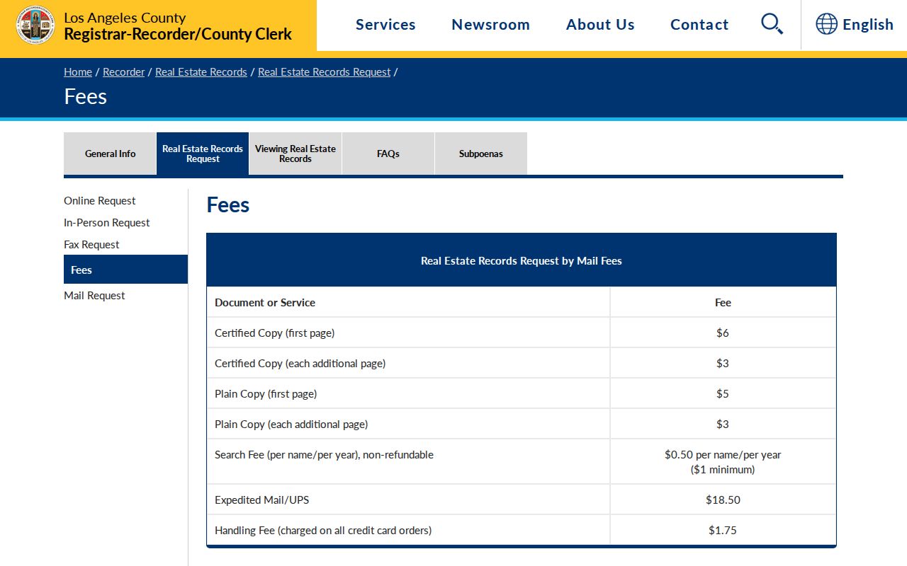
Fee and appointment limits make the offline deed index a planned step in the Downey street directory, not an instant address lookup.
The RR/CC recorded-document request page shows the fallback after a document number or name-and-year lead has been found.
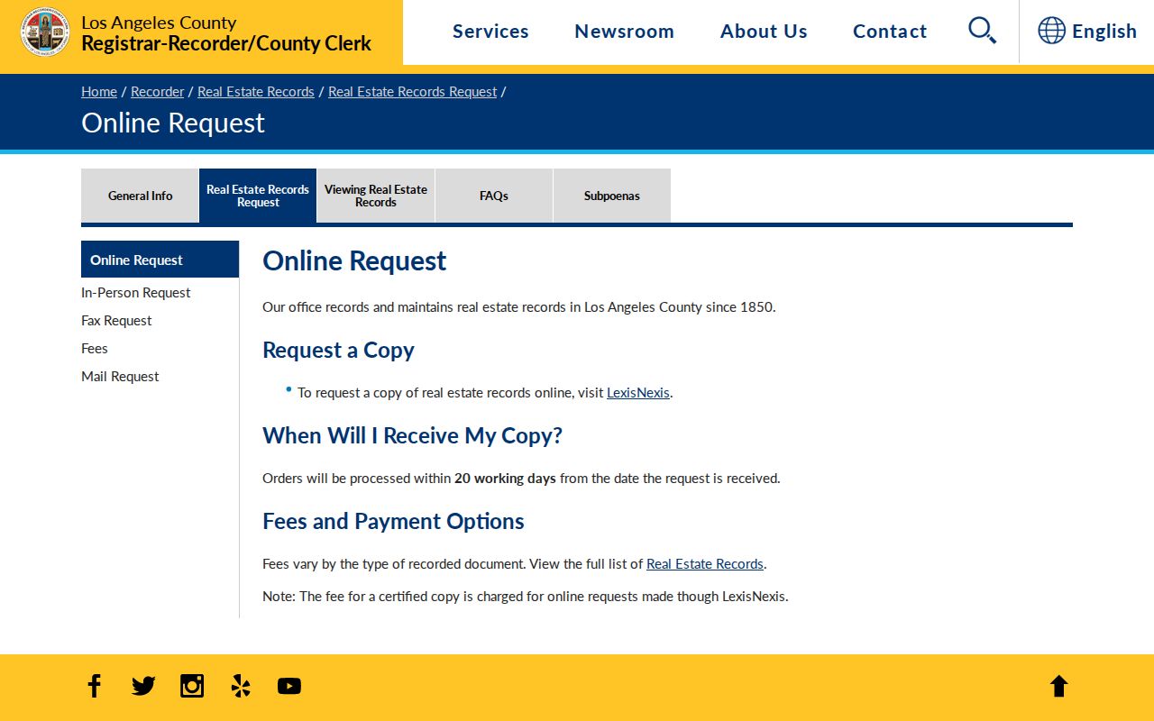
An ordered copy adds the document image or certified paper to the index trail, subject to the county's access rules.
Downey Permits and Code Files by Address
Building and Safety, Public Works, and planning records can add a time line to an address. Applications, project descriptions, issue dates, inspection events, parcel identifiers, certificates of occupancy, and code cases may show work at a site. An applicant, contractor, architect, or property manager is a role in the file, not proof of residence.
Downey moved Public Works permitting to Accela Citizen Access on June 1, 2026 and Building and Safety application and plan submission to the same route on July 1, 2026. Public historical coverage and every field still require live inspection. If no direct search is exposed, ask the City Clerk for existing permit cards, applications, inspection history, certificates of occupancy, and code-enforcement records tied to the address or AIN.
Police reports and calls-for-service records follow separate access rules and may be redacted or withheld. They can show activity at a place without creating a household roster. Use the date range and record title that match the question.
Haines Cross-Cross Directories on Downey Streets
For address history, the LA County Library Californiana holdings are more useful than a generic current search. Haines Los Angeles South Suburban Cross-Cross volumes cover 1981, 1983-1986, and 1988. Haines LA County South Central continues with 1989-1992. GTE Downey and nearby city issues span May and November 1988, May 1989, May 1990, November 1991, and May 1992. Pacific Bell Midcities adds issues from 1988-1992.
Use an edition as a snapshot. Write down the address spelling, listed name, telephone exchange, unit, and exact issue date. A gap between two editions brackets a change but does not tell the day a person moved. Listed subscribers can be missing, delayed, or connected to a business. The later Downey-Norwalk and Downey/Norwalk Area holdings reach into 2001-2016 with gaps and business-focused variants.
The reverse volumes belong to the historical shelf and are treated at length in the Downey city directory collections. On a current street search, use them as one occupant clue beside the parcel, deed, and permit record.
A scanned Assessor parcel detail can show how a current address key is stored.
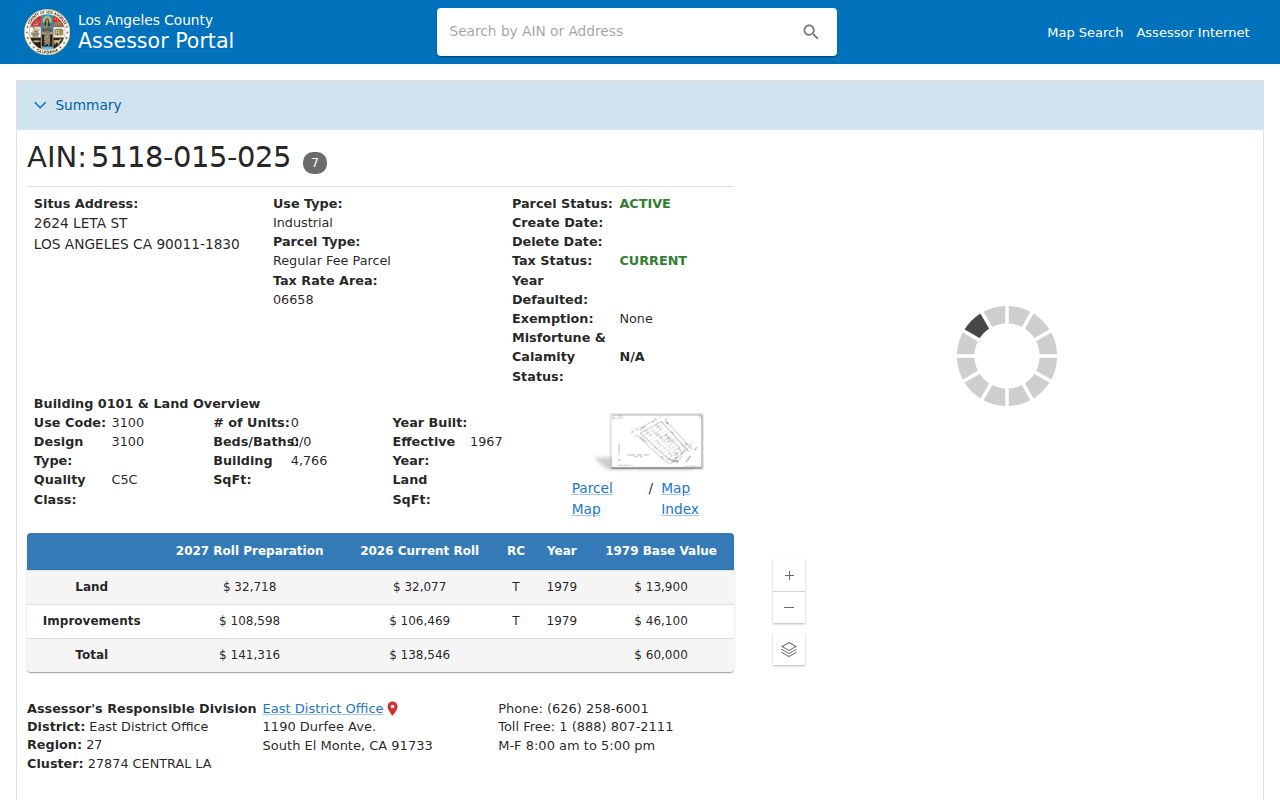
The sample reinforces the bridge from a street number to an AIN, while the cross-cross books provide a separate listed-occupant layer.
Downey Voter Street Index Limits
California's official voter tools authenticate the person using them. They do not offer an unrestricted public browse of Downey voters by street. The county's Street Index may be available to eligible requesters under a contract and permitted political purpose, but it is not a general block directory. Elections Code §§ 2188 and 2194, Government Code § 7924.000, and Elections Code § 18109 set limits on release and use.
A delivered file can include name, residence or mailing address, registration status, dates, party preference, precinct and district, vote-by-mail status, and participation history. It never shows ballot choices. Safe at Home participants and other protected voters are withheld. A record's active, inactive, or cancelled state also reflects election maintenance and should not be read as a real-time residence finding.
For a Downey street directory, use the voter path only when the purpose and requester status qualify. A block researcher who is simply curious should rely on parcel facts and voluntary community contacts instead.
What a Downey Street Directory Cannot Show
No public address chain supplies a complete list of renters, household members, visitors, or people who choose not to be listed. DMV personal data is restricted by the federal Driver's Privacy Protection Act. Utility-customer records are not a substitute. A blank directory entry does not prove vacancy, and a deed owner does not prove who sleeps at the property.
California privacy programs can also remove or replace an address. Safe at Home supplies a substitute mailing address and confidential voter registration for qualifying participants. Sealed court files, juvenile records, adoption records, protected voter data, and redacted police files create other lawful gaps. Respecting those limits is part of accurate street research.
Lawful use. Downey street and address records are for personal, lawful research such as house history, family history, civic curiosity, and safety awareness. Using them to stalk, harass, intimidate, or harm anyone is prohibited and can trigger California civil or criminal consequences.
The strongest Downey street directory result says exactly what the parcel, deed, permit, voter, and reverse-directory entries show, then stops where the record stops.